Modernizing Field Operations with GeoAI
At AirWorks, we combine AI, geospatial analysis, and human expertise to accelerate engineering workflows and set a new standard for field intelligence.

We empower clients with next-gen, AI-enabled geospatial processing that accelerates workflows and ensures accurate, reliable project delivery.
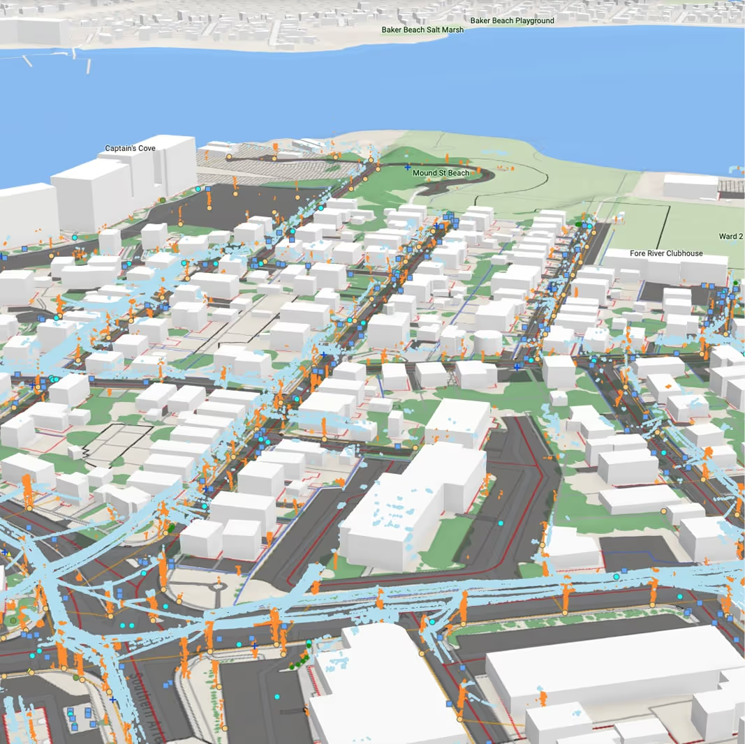
We believe AI can make geospatial insights faster and more accessible for every team. Our tools and expertise help clients integrate data seamlessly into their workflows and drive confident, data-informed decisions.
.avif)
We care deeply about our clients. From personalized guidance to reliable service, we ensure you get exactly what you need to achieve your goals.
Built for the Demands of Your Industry
.avif)
Telecommunications & Power
.avif)
Architecture, Engineering, & Construction

Government
Meet Our Founders
Driven by a shared belief in AI and automation, our founders created AirWorks to accelerate the way infrastructure gets built.
Co-Founder

Co-Founder

Join Our Team
Join a team of builders, analysts, and innovators working to modernize infrastructure through geospatial intelligence.


Field Notes Blog
Our team shares relevant insights and inspirations from the field so you can stay up to date on the latest in field data intelligence.
.png)
.jpg)
Professional Memberships
Committed to staying at the forefront through active industry involvement.


Upcoming Event
AirWorks will be exhibiting at Broadband Communities Summit 2026 in Houston, a leading event for service providers and community leaders.
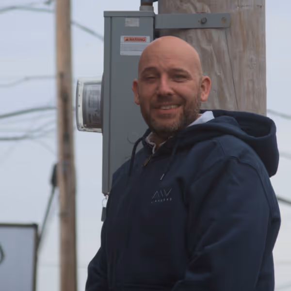
David Morczinek
CEO & Co-Founder
Driven by a vision to bring automation and AI into field intelligence, David leads AirWorks in building solutions that balance speed and precision for infrastructure projects of every scale. His career began in aerospace, where he spent nearly a decade at Airbus, negotiating international contracts and managing programs for the A350 XWB. After earning his MBA from the MIT Sloan School of Management, David conducted research in aerial data management, machine learning, and big data — work that ultimately led him to launch AirWorks through MIT’s delta V accelerator. David also holds a degree in aerospace engineering from the University of Technology in Hamburg, with research experience spanning France, Germany, and China.
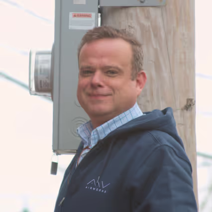
Adam Kersnowski
Chief Evangelist & Co-Founder
Adam’s vision for advancing field data capture and geospatial AI enables AirWorks to serve as a trusted partner for telecommunications and engineering companies of all sizes. Before empowering others with these technologies, Adam applied them to his own walkout and field data collection needs while founding — and eventually selling — two companies in the drone data acquisition and construction industries. A certified FAA pilot, he has been consulting on engineering projects for over 20 years.