Power Government Projects with Rapid Geospatial Insights
Enable your public works and planning teams to track assets, monitor projects, and maintain digital twins in a centralized environment.
Bring Visibility and Efficiency to Infrastructure Management
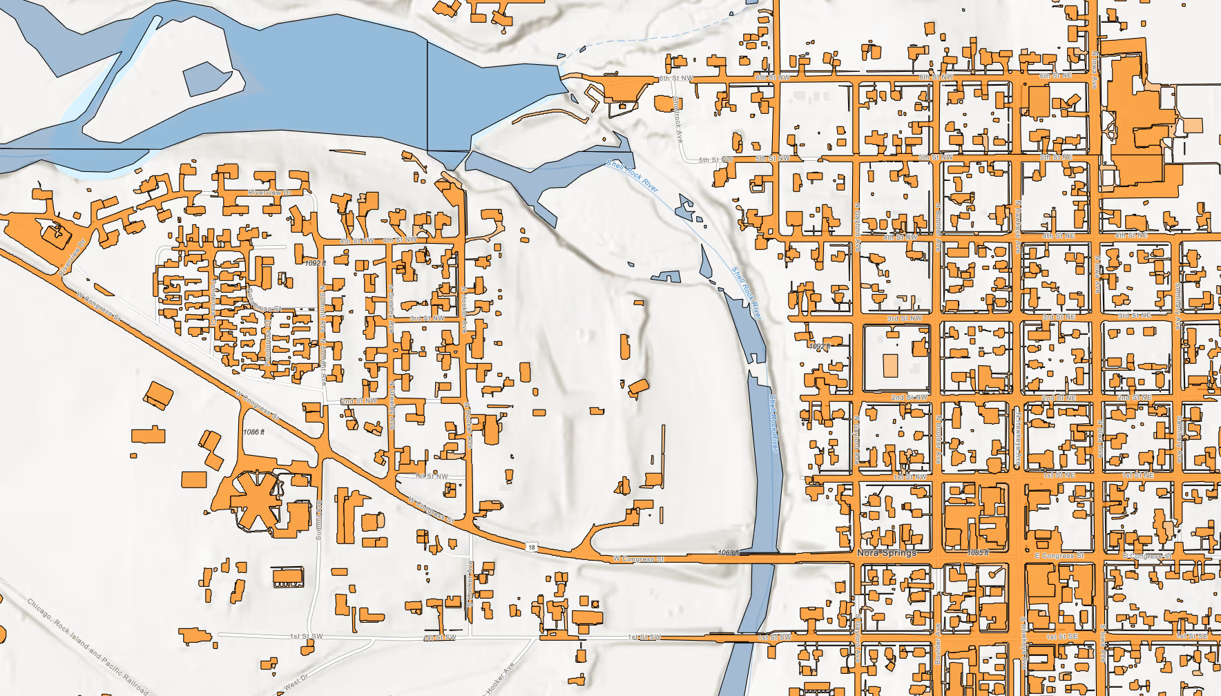
Rapidly map and monitor impervious surfaces to support property assessments for taxes, detect changes, and drive faster planning decisions.
Build detailed, real-time models of entire cities or major assets to enhance planning, maintenance, and decision-making at scale.
Track, assess, and maintain roads, bridges, and utilities efficiently with precise geospatial data.
Leverage detailed spatial data to ensure accurate property assessments and fair valuations.
Proactively model and manage water flow to prevent flooding and protect critical assets.
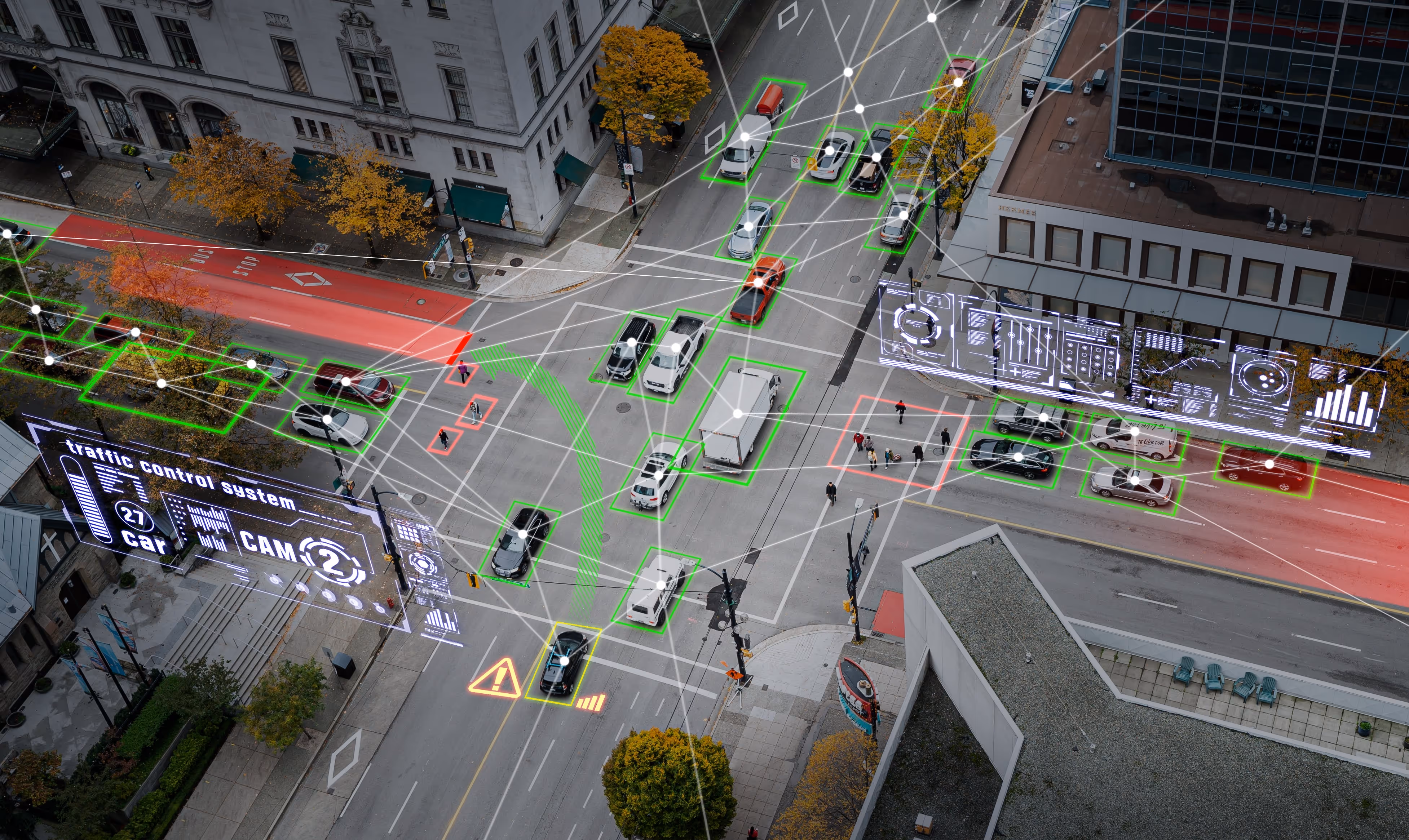
Monitor and manage infrastructure from anywhere, reducing site visits and operational risks.
Use spatial insights to plan projects that enhance livability, safety, and sustainability.
Integrate data across systems to optimize urban services, improve efficiency, and enhance citizen experiences.


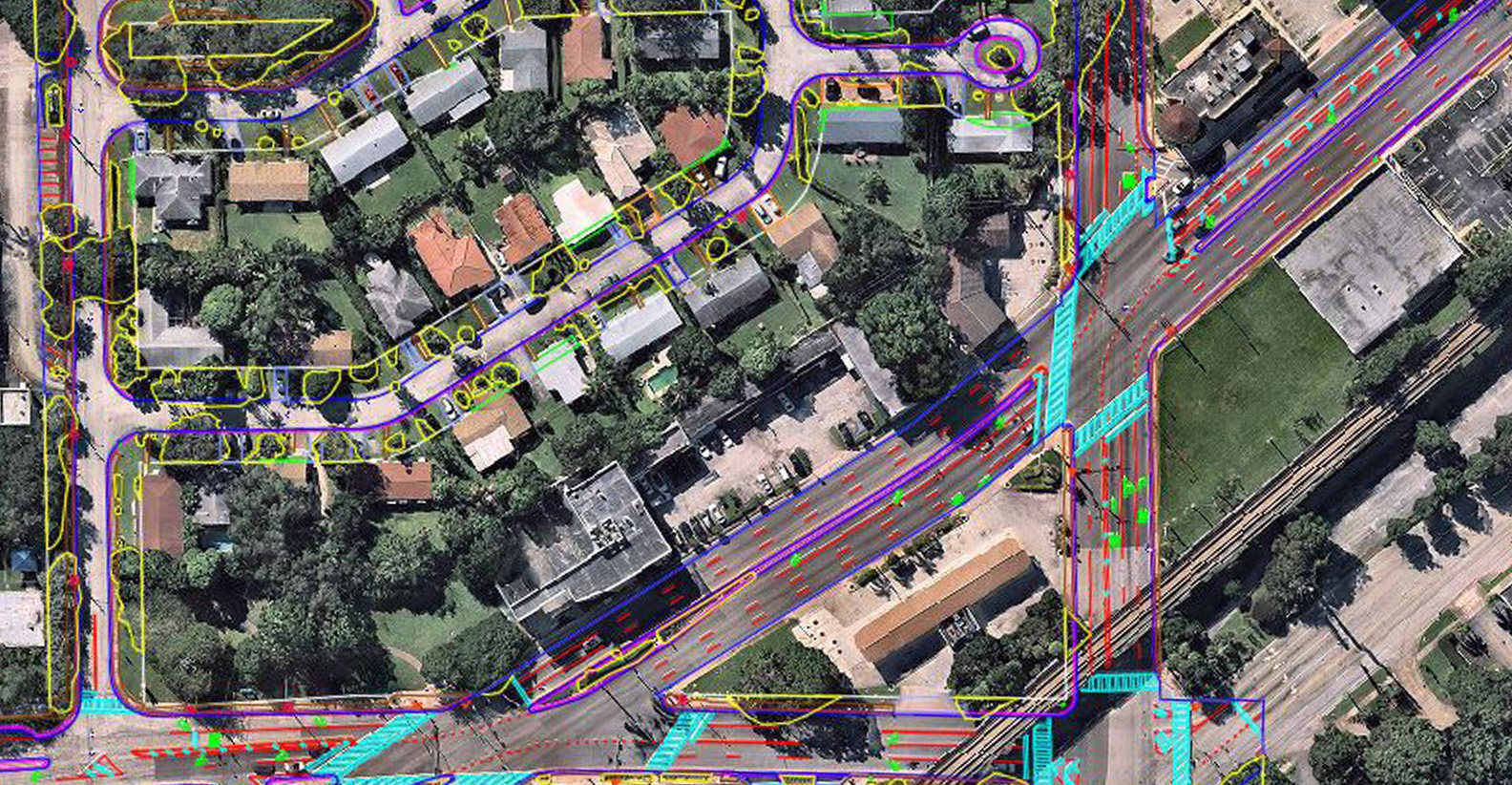
Kimley-Horn Cuts Conceptual Design Surveying Fee by 50% Using Drone Technology and AirWorks’ Automated Drafting Software.
Customer Success Stories
See how AirWorks can assist with your next project.

.webp)
.png)


.webp)

Smarter planning, permitting, monitoring, and deployment.

.svg)
