Build Confidently from Day One with Accelerated Field Insights
AirWorks speeds up field operations, elevates planning workflows, and helps you reach revenue faster with our flexible field intelligence solutions.
New Builds:
Measuring Market Potential with Precision
Homes Passed
AirWorks accelerates homes passed analysis by rapidly creating a network map from aerial imagery and LiDAR. We layer in accurate address and infrastructure data to produce outputs that help you quantify the number of service-ready premises in a target area, supporting precise market sizing and expansion planning.
Take Rate Analysis
AirWorks enables faster take rate forecasting by delivering the foundational geospatial data you need to pair with demographic and market insights. This allows teams to quickly estimate subscriber adoption and assess the ROI of network investments.

Time to Revenue Analysis
By streamlining data capture and design workflows, AirWorks helps reduce the time from concept to customer. Our high-accuracy deliverables accelerate permitting, planning, and deployment to get your network generating revenue sooner.
New Builds:
Design and Planning at Full Speed

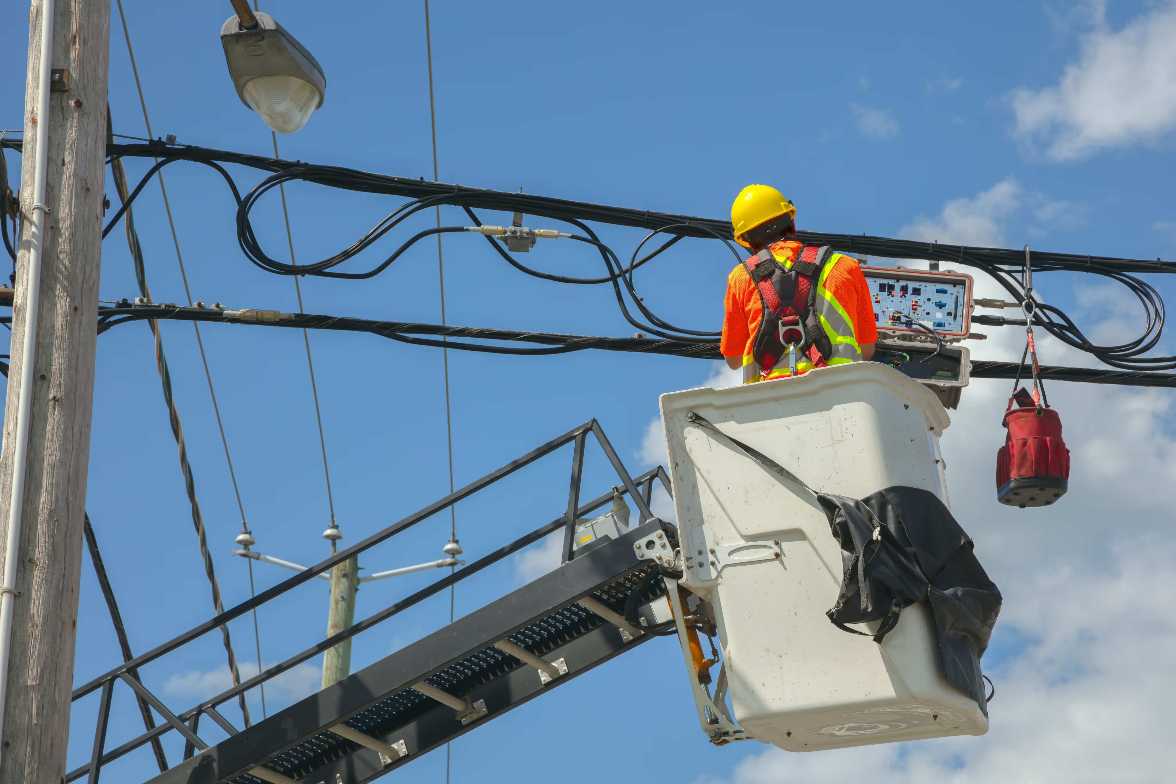
Automated Walkouts
AirWorks streamlines the walkout process by leveraging next-gen technology to extract key infrastructure from field data and imagery dramatically faster than traditional methods can. Our outputs quickly identify pole measurements and locations, manholes, cabinets, valves, vegetation, existing and potential cable routes, obstructions, and much more. This reduces time in the field, accelerates planning, and provides your team with a digital twin of your project site to help elevate their engineering process.

Feasibility & Planning Design
AirWorks delivers the foundational data you need to assess site viability, identify potential constraints, and support concept development. We provide fast, high-accuracy linework and digital twins that support tasks like route studies, constructibility assessments, and cost estimation. Whether you’re evaluating a new fiber build, substation siting, or infrastructure expansion, AirWorks helps you make informed decisions faster.

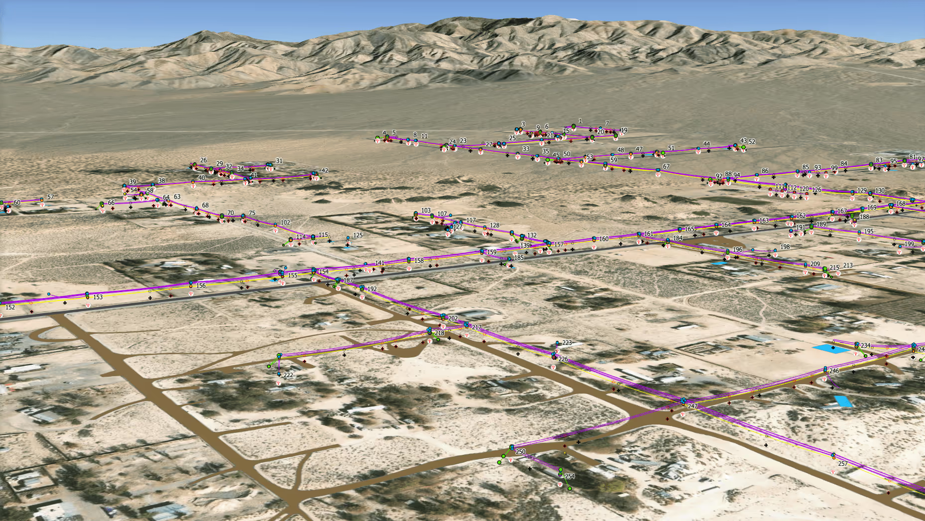
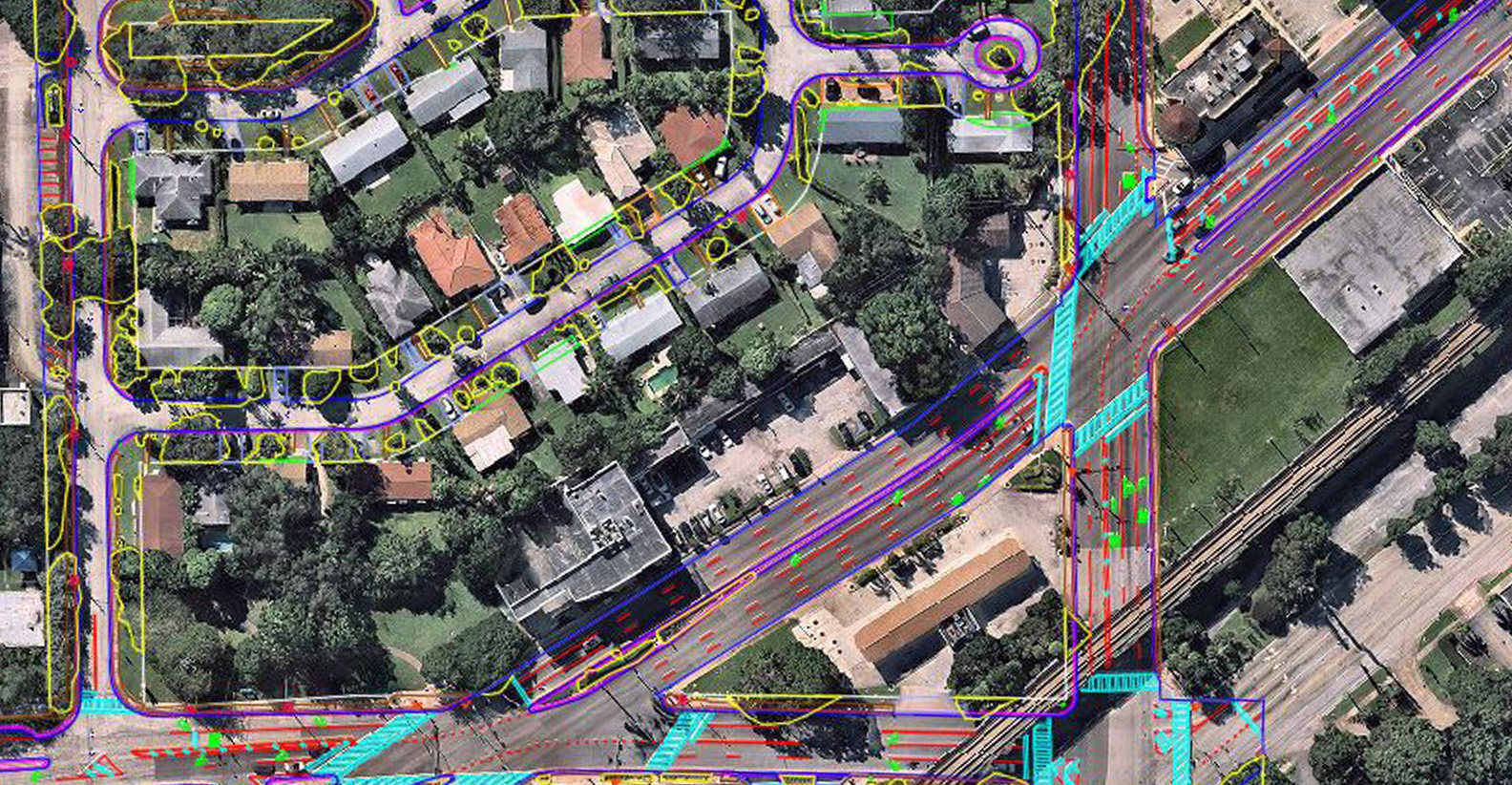
OSP Utility Mapping
AirWorks supports network design by extracting detailed surface features from orthomosaic imagery, LiDAR, and other geospatial data sources. We deliver clean, flexible linework that helps engineers plan trench paths and identify surface obstructions early in the process. Whether you’re designing for telecom, power, or joint-use builds, our outputs accelerate alignment, streamline permitting, and help you tackle your project with complete confidence.
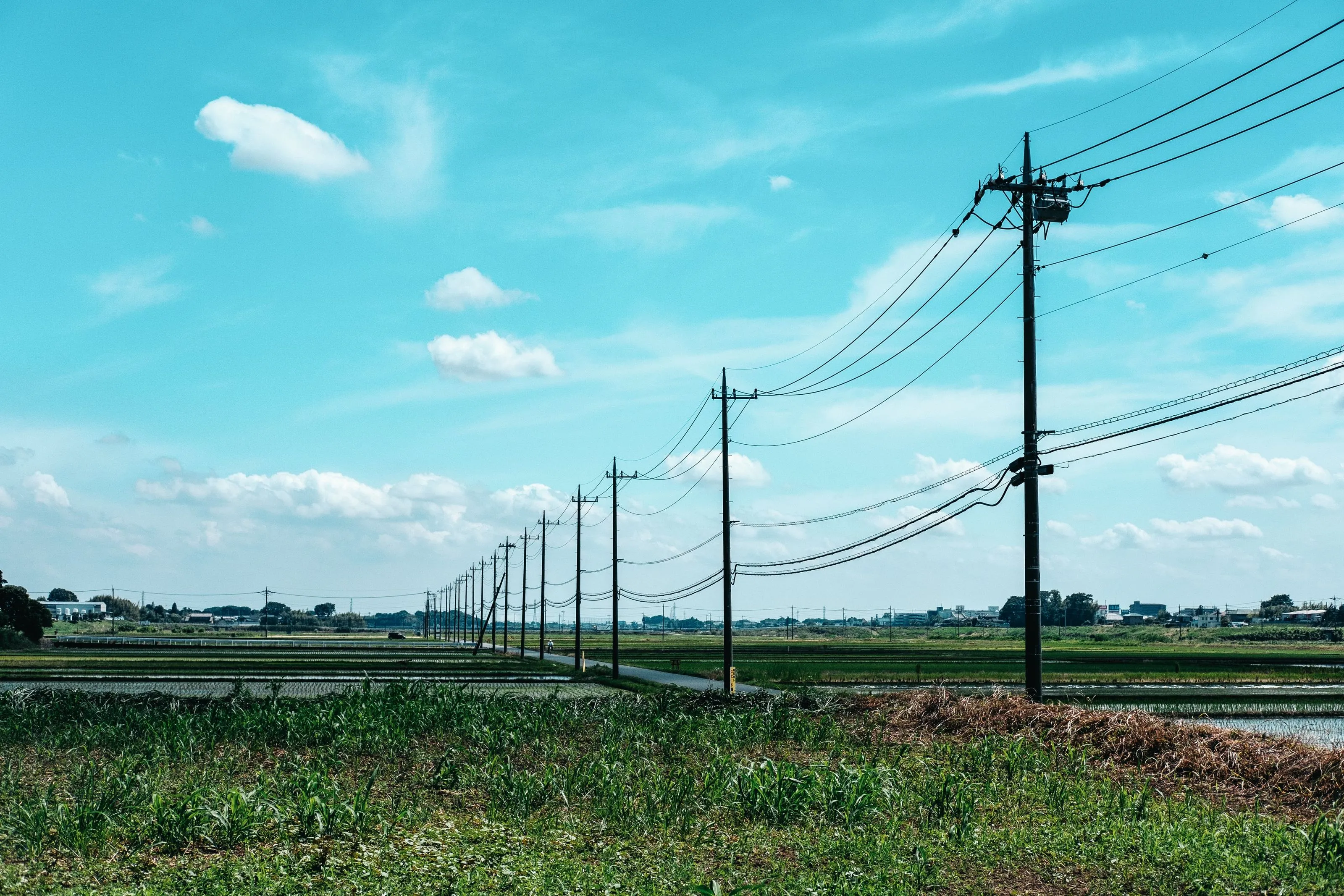
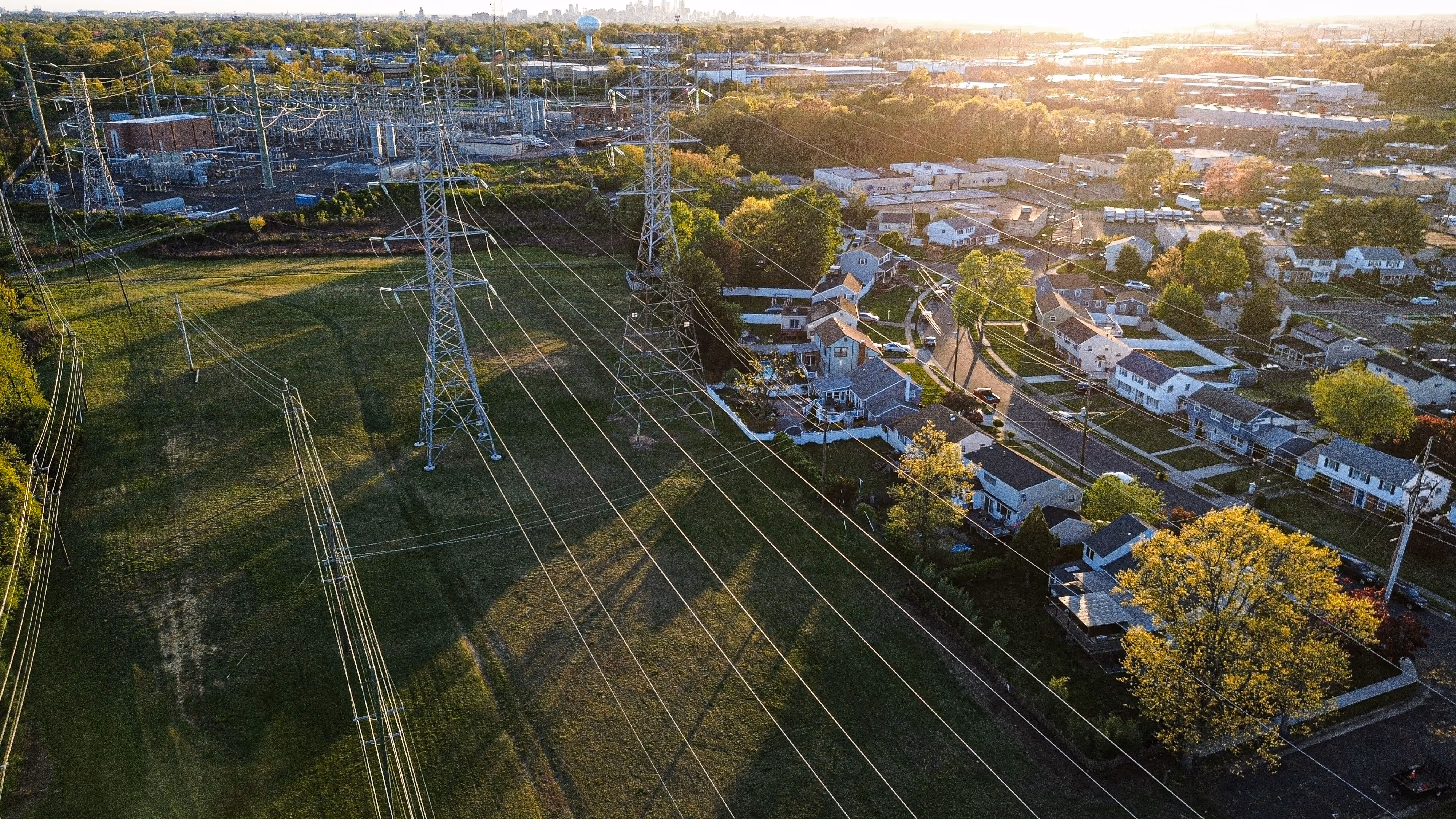
Aerial Design Planning
AirWorks supports aerial network design with detailed 3D outputs derived from LiDAR and high-resolution imagery. We extract pole measurements and locations, attachments, vertical clearances, vegetation encroachments, and surrounding infrastructure to give your team a precise digital view of the existing environment. This allows engineers to validate feasibility, identify make ready and pole-loading requirements, and develop aerial routes with greater speed and confidence.
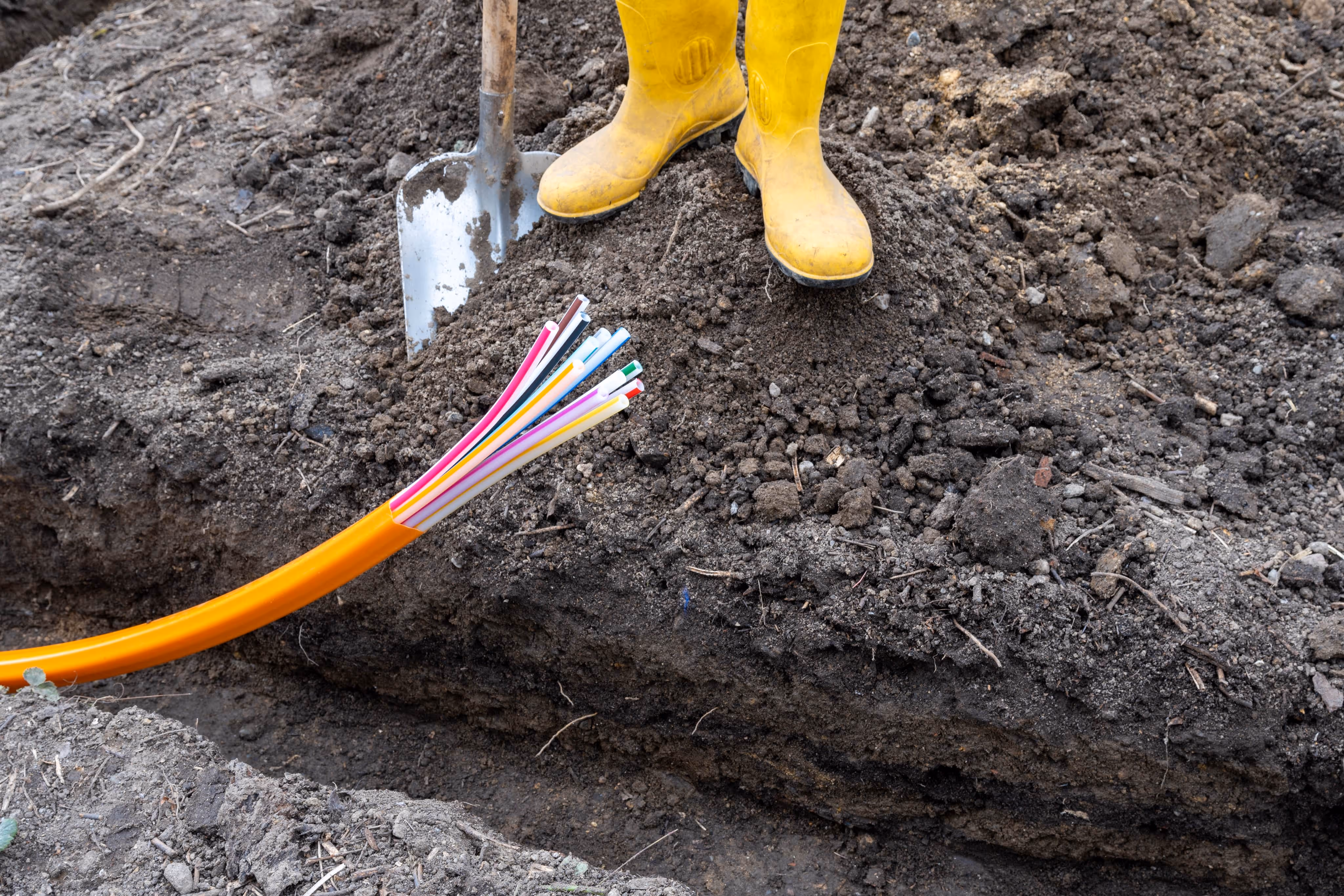
Underground Design Planning
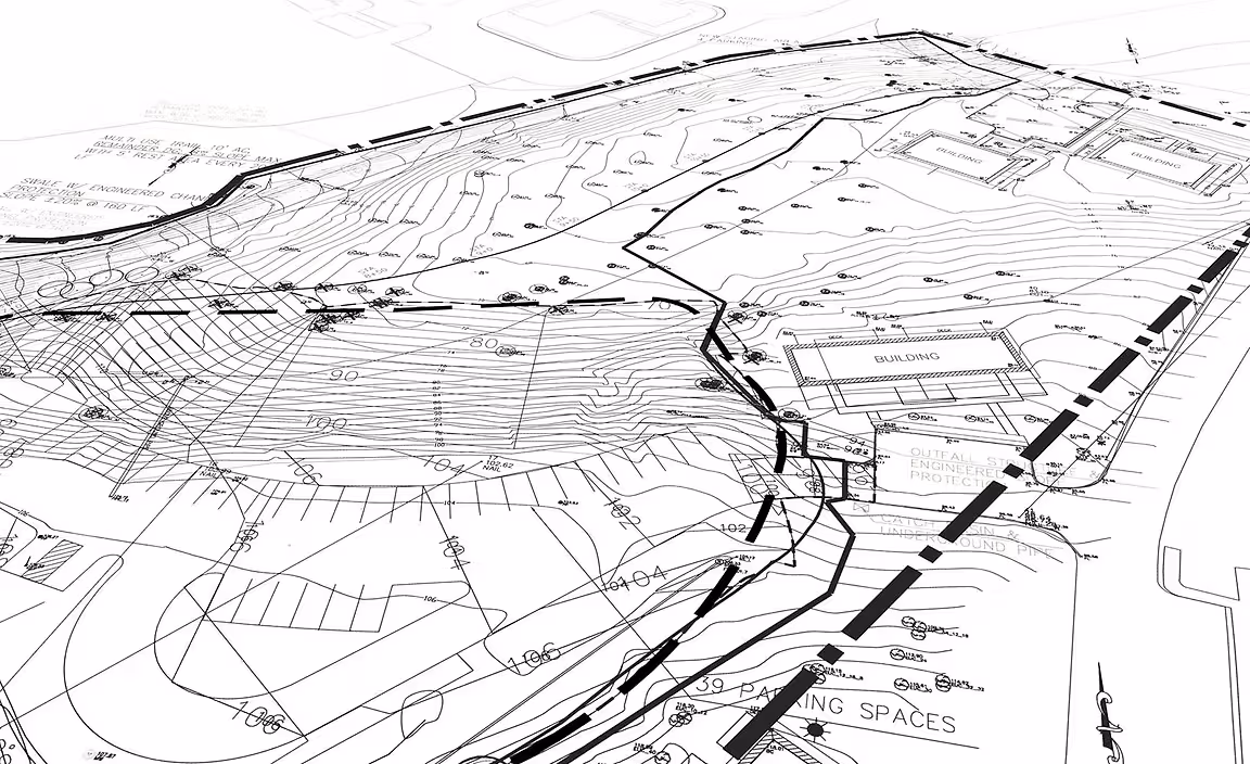
AirWorks accelerates underground network design by delivering detailed linework from geospatial imagery. Our deliverables capture surface features, underground access points, and potential conflict zones to help engineers design trench routes and conduit layouts with precision. By integrating accurate geospatial data into your workflows, we reduce field visits, flag constructibility issues early, and streamline permitting. The result is faster, more cost-effective underground design that keeps your project moving forward.
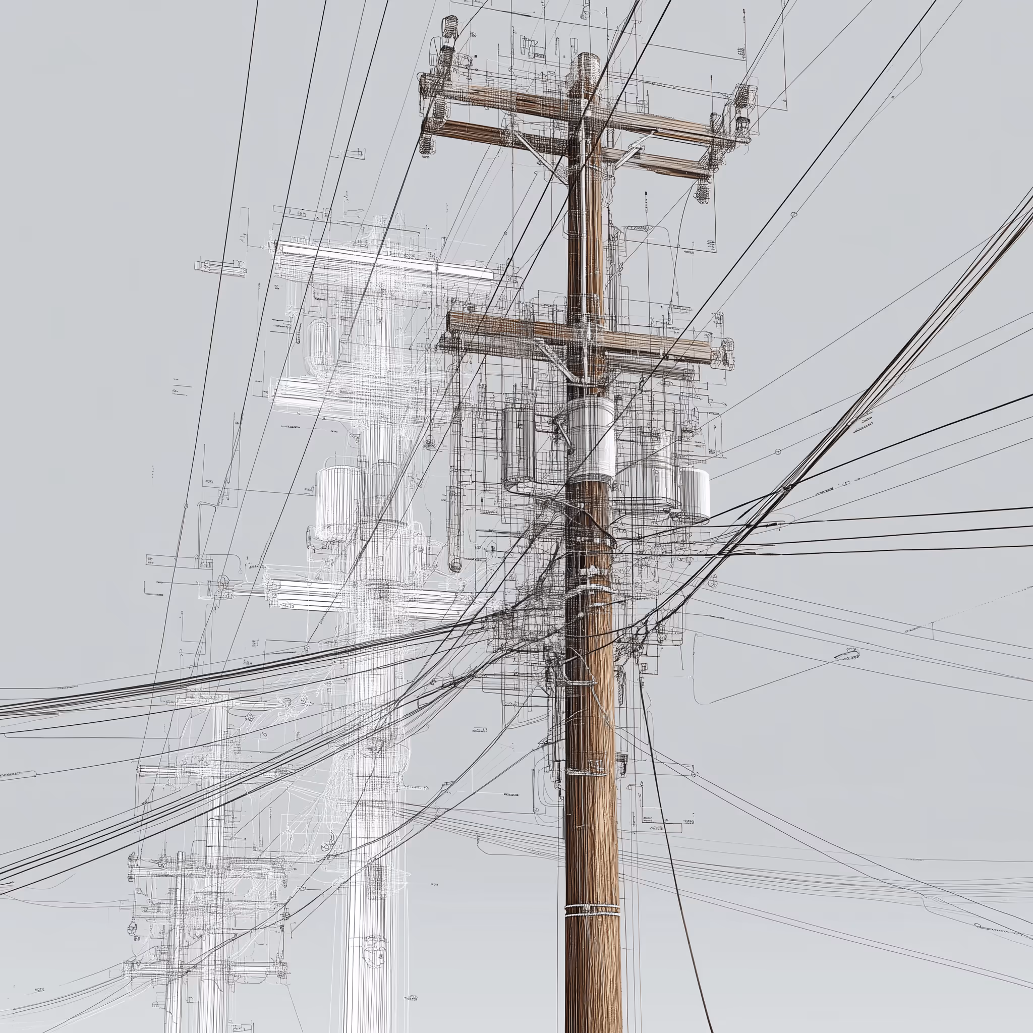
Make Ready Pre-Engineering
AirWorks delivers pole-level features, span measurements, attachment details, and clearance data to support pre-engineering for make ready assessments. Our outputs help your team quickly identify potential violations, capacity constraints, and permit-triggering conflicts. By providing clean, structured data in formats ready for pole loading analysis and permitting, we shorten timelines and optimize your make ready operations.
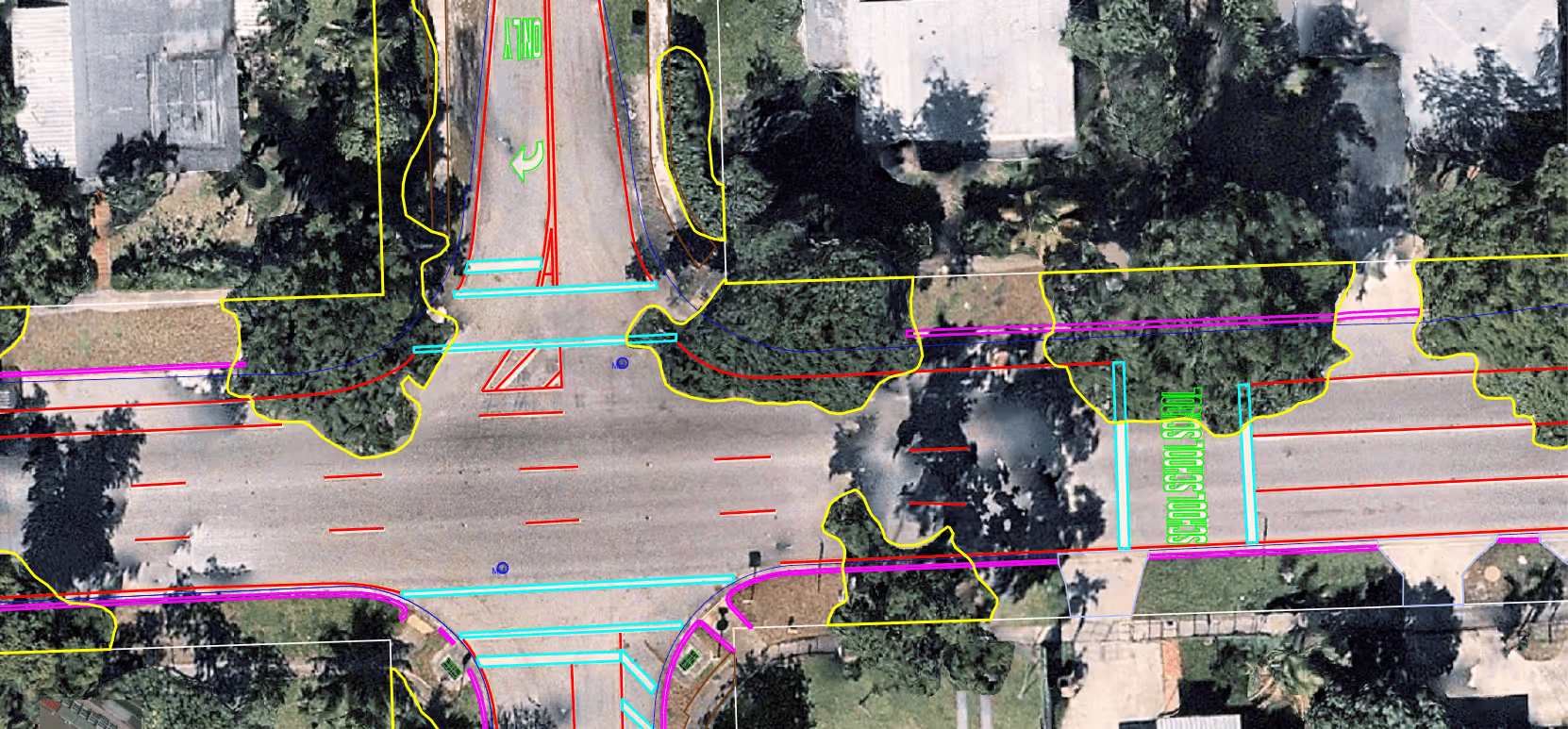
ROW Mapping
AirWorks streamlines Right-of-Way (ROW) mapping by transforming aerial imagery and LiDAR into precise, engineering-ready datasets. We capture boundaries, easements, encroachments, utilities, vegetation, and surface features to give your team a clear picture of existing conditions along the proposed corridor. Our outputs help engineers validate alignment options, identify potential conflicts, and support permitting and coordination with municipalities or private landowners. With fast delivery and high-accuracy geospatial data, AirWorks simplifies the ROW process and helps your project advance with fewer surprises and greater confidence.
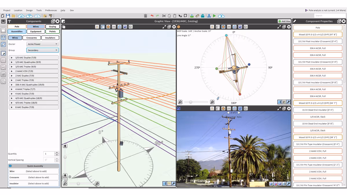
Pole Loading Analysis
AirWorks provides structured pole-level data to support accurate and efficient pole loading analysis. We extract pole heights, span lengths, attachment types and locations, and surrounding vegetation from LiDAR and imagery, delivering outputs formatted for use in a wide variety of industry-standard pole loading software. This reduces time-consuming manual data collection and ensures engineers have the precise measurements needed to evaluate structural capacity and plan safe, code-compliant designs.
BOM (Bill of Materials)
AirWorks supports accurate and efficient Bill of Materials (BOM) generation by helping your team identify exactly what materials are needed for your project and what already exists in the field. By providing structured, location-specific data on poles, strands, cabinets, handholes, and other key assets, we help teams estimate material requirements based on actual site conditions. This includes both identifying where new infrastructure must be placed and confirming where usable, existing infrastructure is already present. The result is a faster, more informed planning process that reduces overordering, minimizes field revisions, and helps align engineering with procurement.
As-Builts
AirWorks helps teams generate accurate post-construction documentation by extracting infrastructure details from newly captured aerial imagery or LiDAR. We identify poles, cables, handholes, equipment, and other placed assets to create clean, geospatially aligned as-built deliverables that can support closeout packages, permitting compliance, and integration with asset management systems.
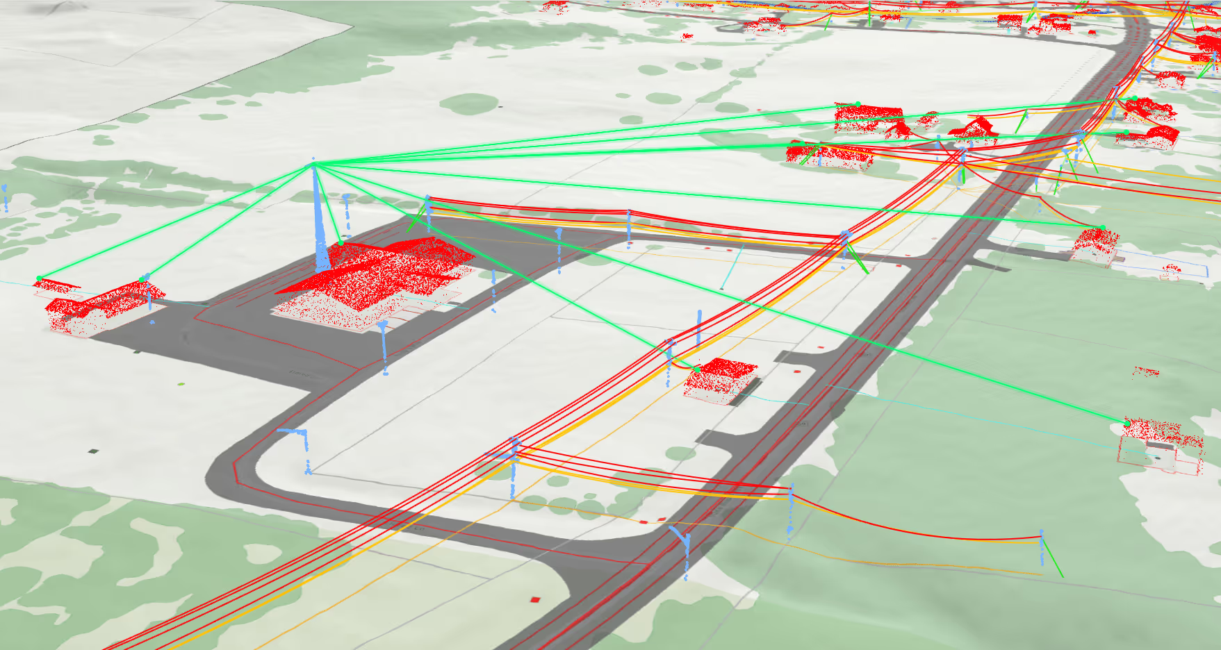
Viewshed
AirWorks leverages 3D viewshed analysis from high-resolution imagery and LiDAR to quickly assess wireless connectivity and plan network layouts with confidence.
Maintenance:
Empower Your Team to Manage the Unexpected
Customer Success Stories
See how AirWorks can assist with your next project.


.webp)
.png)


.webp)
