The New Standard for Field Intelligence
AirWorks streamlines geospatial analysis, giving your engineering team fast, accurate outputs without the manual bottlenecks.
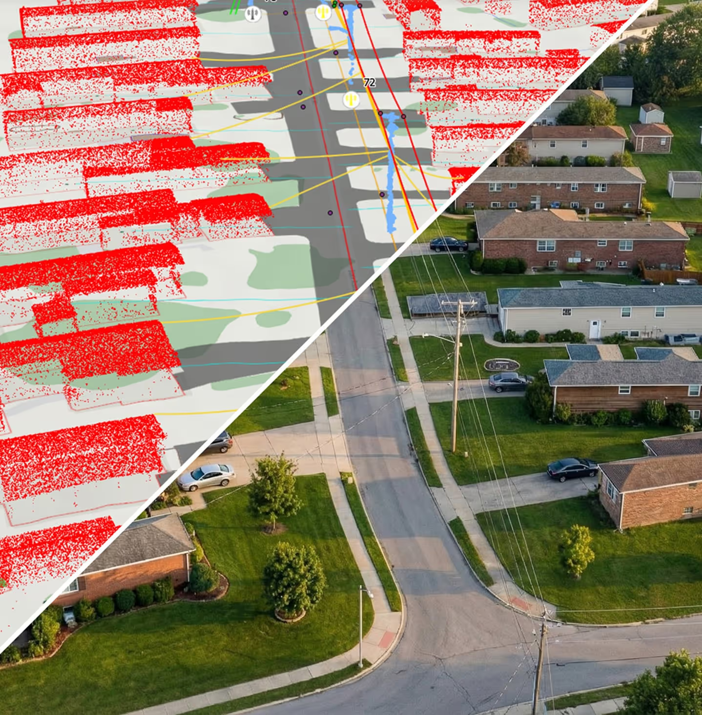
Our AI-powered platform accelerates field data processing, reducing turnaround from weeks to days. By automating the complex and time-consuming process of object identification from aerial imagery and LiDAR, we help your team rapidly obtain the ground truth to confidently move forward with projects.

Accuracy is critical in engineering, so it’s built into every step of our workflow process. We combine the right resolution for your project needs, patented AI built for geospatial data extraction, and rigorous quality reviews from U.S.-based experts to deliver precise results you can trust every time.

AirWorks is data-agnostic, meaning we can work with any format for both inputs and outputs. We work with imagery and point cloud data from any source: satellites, aircrafts, drones, LiDAR, field surveys, and more. We deliver in CAD, GIS, PDFs, or software-specific formats to align with your tools and workflow.

AirWorks delivers accurate digital twins and maps that reduce manual effort, helping engineers focus on higher-level tasks like planning, analysis, and design. With less time spent processing data, teams can take on additional, larger projects.
The AirWorks Advantage
7x Faster
Than traditional data processing methods
18+ Miles Mapped/Day
Average walkout surveys: 3 miles/day
Data Agnostic
Compatible with any data source and system of record
2-Pixel Accuracy
From aerial imagery inputs
If You Can See It, We Can Extract It
100+ extractable layers with customizable field features.


Hear From Our Customers
Director of Professional Savings
"We’re able to do more with fewer number of designers – it’s not only a time savings but an overall cost savings. What we pay per project is significantly less than the additional manpower that would be needed to handle these ourselves."

Executive Vice President
We were hoping to see a 70-80% reduction in drafting by using AirWorks, and it certainly happened. The accuracy is there, and the fact that we don’t have to do all of that work manually is huge for us.

Corporate Design Technology Manager
"I think the final selling point for us was really the cost per acre versus the manhour cost for doing the same type of work. You get good quality data in a lesser amount of time, for less cost, and you’re not taking someone away from other important tasks. With all that said, it was kind of a win-win all the way around."

UAS Operations Manager and IT Systems Manager
Something we looked very closely was the accuracy of the final linework – even comparing it to data we did collect in the field, like curb corners. We had the ground survey crew get a couple of stripes just to compare and the accuracy was very good. That’s a big reason why we keep using AirWorks.

Survey Department Manager
"Using AirWorks is basically like getting another two drafters for one tenth of the cost with half the amount of time a person would take and be compensated for."

Project Manager
"When comparing the cost of what it would take for us to provide CAD support versus working with AirWorks, there was a significant cost saving."

Vice President and Survey / Geospatial Principal
"From the time-savings to the quality level AirWorks maintains, for us it was a no-brainer to move forward."
Customer Success Stories
See how AirWorks can assist with your next project.
.webp)
.webp)

.webp)
.jpeg)
